
Leganés Norte
Data → public strategy
Urban systems analysis that framed the Leganés Norte competition.
Context
Developed as part of the IE Center for Sustainable Cities in collaboration with the Comunidad de Madrid and Ayuntamiento de Leganés, this project contributed to the strategic foundation of a large-scale urban development and future international design competition.
The objective was to define the conditions, constraints and opportunities of the site, so that future design proposals could respond to its complexity.
Site
North Leganés, Madrid, Spain. Urban development site.
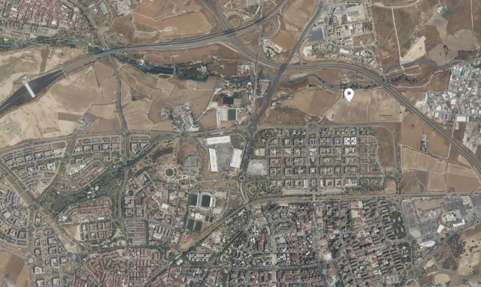
Source: Comunidad de Madrid Strategic role
Developed the analytical foundation of the project by structuring multi-layered urban data into a coherent system to inform strategic decision-making.
Iterative process of constructing a multi-layered urban system from fragmented data. Urban system framework
A multi-layered framework to understand the territory as an interconnected urban system.
From fragmented data to systemic urban understanding. System dynamics
Understanding how layered systems interact to produce urban conditions. Systems do not operate independently, their interactions define the city.
Mobility → Emissions → Air quality
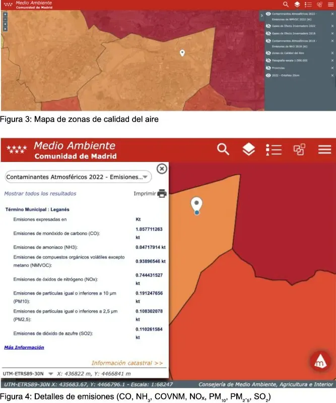
Mobility patterns directly shape emission levels and urban air quality.Source: Comunidad de Madrid Urban structure → Accessibility → Mobility behaviour
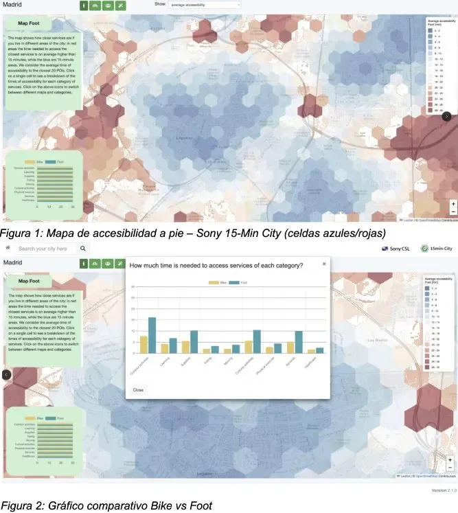
Urban form directly determines accessibility, which shapes how people move.Source: Sony 15-min city Natural systems → Urbanization → Ecological fragmentation
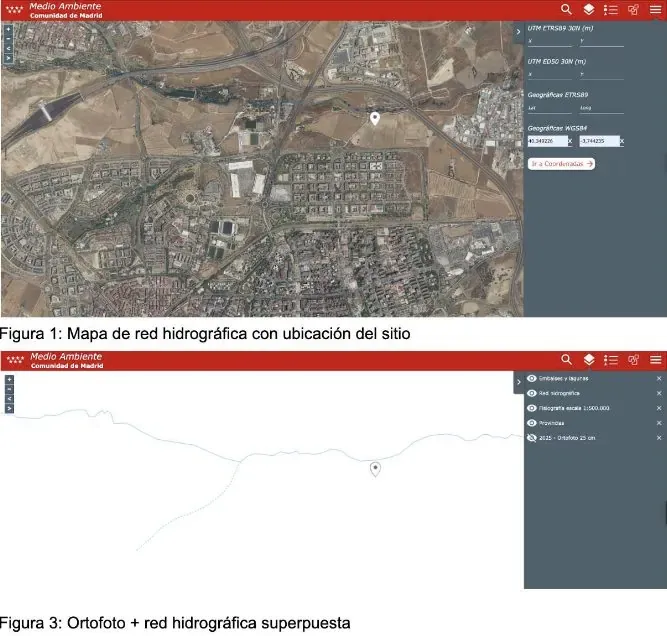
Urban development has transformed natural systems, but these still structure the territory and offer opportunities.Source: Comunidad de Madrid Acknowledgement
The contribution is credited in the final institutional report.

From the acknowledgements of the final report for the Consorcio Urbanístico Leganés Norte. IE Center for Sustainable Cities, December 2025.
Due to the ongoing nature of the project and its institutional context, selected materials are presented to illustrate the analytical approach without disclosing the full report.